Walk of the Month: Inis Meain – Lub Cill Cheannannach
Ireland’s offshore islands are a paradise for walkers, offering a remarkable variety of trails – from short looped walks and strolls to lengthy hikes that will really blast away the cobwebs.
What they have in common is, along the way, you’ll be treated to dramatic scenery, undisturbed nature and a huge collection of fascinating historical treasures.
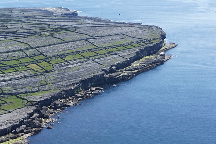
Our walk of the month takes us to Inis Meain, one of the three Aran Islands that lie off the west coast of Co. Galway. These stunning islands are home to some great people, attractions and activities to keep you busy for weeks!
Inis Meain is the second largest of the Aran Islands and its name aptly translates directly to the ‘middle island’ in English.
Stunning views, beaches, ruins and good times await on this moderate but beautiful looped trek.
Route:
Leaving the trailhead at the pier, follow the blue (and green and purple) arrows along the surfaced road. The green arrows are for a shorter loop, the purple arrows for a longer one.) After 200m pass a roadway on your left. This is the point from where the loop ‘proper’ begins – you will be returning to this point from the left later – for now continue straight. After 200m you reach a 3-way junction – veer right.
Follow the coastline for 200m and turn left onto a surfaced road. Follow this road for almost 3km (passing 3 road junctions) to reach a junction from where you can make a detour to Synge’s Chair (on your right). The views are well worth the 45min-1hr trek – don’t forget to return to this point to continue the loop.
Continue to follow the road for 300m to reach Dún Chonchúir (on your right). Shortly afterwards, pass the church and Teampaill na Seacht Mac Rí (both on your right) to reach a Y-junction. Here the green loop veers left – you continue straight – following the blue (and purple) arrows. The loop travels up the ‘main street’ of the village to reach a signpost for Dún Fhearbhaí – turn right here.
After only 100m the purple loop turns right onto a narrow track but you continue straight on. After 200m you reach a track on your left where you leave the tarred road and make your way downhill to reach the ruins of Cill Cheannannach. Pass the ruins and 100m afterwards, join a surfaced road near the old pier. Proceed straight on here following the blue and purple arrows and the signpost for Tra Leitreach.
Pass Tra Leitreach (on your right) and the cemetery (on your left). Continue to follow the roadway for 1km when it swings left and runs parallel to the airport runway. At the end of the runway turn left at a T-junction, then immediately turn right and follow the network of green roadways and minor roads to regain the junction at B above. This time, veer right and enjoy the last 200m back to the trailhead at the pier.
10km / Duration: 3hrs – 4hrs

Via Discover Ireland